$14.95
$11.95
(SAVE Now!)
as of 04/27/2024 (Details)
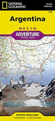
• Waterproof • Tear-Resistant • Travel MapNational Geographic's Argentina AdventureMap is designed to meet the unique needs of adventure travelers with its durability and accurate information. This folded map provides global travelers with the perfect combination of detail and perspective, highlighting hundreds of points of interest and the diverse and unique destinations within the country.The map includes the locations of cities and towns with a user-friendly index, plus a clearly marked road network complete with distances and designations for major highways, main roads, and tracks and trails for those seeking to explore more remote regions.The north side of the Argentina map details the most highly populated areas of the country including the provinces of Buenos Aires, Córdoba, and Santa Fe as well as the impressive landscape of the Cordillera de los Andes bordering Chile on the northwest. Vineyards in Mendoza, Argentina's world-renowned wine producing province are included, as are ski areas in this popular tourist region. An inset map shows the small province of Misiones that juts into the neighboring countries of Brazil and Paraguay. The south side of the map details Argentina's extensive coastline from Mar Del Plata to Tierra Del Fuego highlighting beaches, preserves, and areas noted for fishing and surfing.Every AdventureMap is printed on durable synthetic paper, making them waterproof, tear-resistant and tough — capable of withstanding the rigors of international travel. Each is two-sided and can be folded to a packable size of (4.25" x 9.25"); unfolded size is (26" x 38").Key Features:- Waterproof and tear-resistant- Accurate topography/terrain with a clearly labeled road network- Hundreds of points of interest, including the locations parks and nature reserves, protected lands, historical and cultural attractions- Thousands of place names including towns and natural features; detailed place names index- Important travel networks including airports, lighthouses, ferry routes and rail lines- Updated regularly to ensure accuracyProceeds from the sale of National Geographic maps go to support the National Geographic Society's vital exploration, conservation, research and education programs.Map Scale = 1:2,300,000Sheet Size = 25.5" x 37.75"Folded Size = 4.25" x 9.25"
Technical Details
- Printed on waterproof material.
- Tear resistant.
- Stands up to the rigors of travel.
- Folded size: 4.25 H x 9.25 W.
- Made in USA.