$292.37
$292.37
(SAVE Now!)
as of 04/26/2024 (Details)
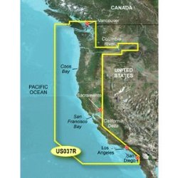
Get a fresh perspective when you take to the water with BlueChart g2 Vision. With BlueChart g2 Vision data, you'll get detailed marine cartography that provides convenient viewing of nautical content and other premium features. BlueChart g2 Vision allows you to see your vessel's precise, on-chart position in relation to naviads, coastal features, anchorages, obstructions, waterways, restricted areas and more. You will also have access to detailed mapping capabilities that include Safety Shading, Fishing Charts, smooth data transition between zoom levels, harmonious transition across chart borders, and reduction of chart discontinuities. Premium features include 3-D perspective above and below the waterline, Auto Guidance, high-resolution imagery, and “real picture” aerial photos of ports, harbors, marinas, waterways, landmarks and other points of interest. It's the most realistic mapping display Garmin has ever offered.
Technical Details
- Realistic navigation features showing everything from shaded depth contours and coastlines to spot soundings, navaids, port plans, wrecks, obstructions, intertidal zones, restricted areas, IALA symbols and more
- Smooth display presentation including seamless transitioning between zoom levels and more continuity across chart boundaries
- Safety shading allows user to enable contour shading for all depth contours shallower than user-defined safe depth
- Fishing charts to help scope out bottom contours and depth soundings with less visual clutter on the display.
- Includes high-resolution satellite imagery, aerial reference photography, MarinerEye 3-D view, FishEye 3-D view and Auto Guidance technology. Also compatible with Garmin's HomePort software.