Chartplotters

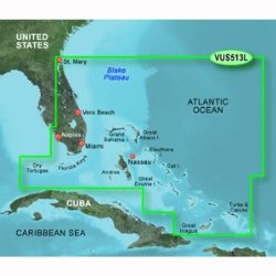
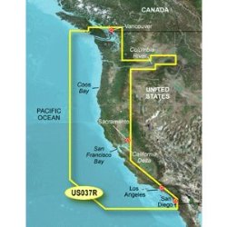
Garmin BlueChart g2 Southeast Caribbean Saltwater Map microSD Card

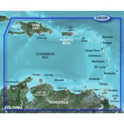
See your surroundings more clearly with BlueChart g2 data. With BlueChart g2, you’ll get detailed marine cartography that provides convenient viewing of nautical content. BlueChart g2 allows you to see your vessel’s precise, on-chart position in relation to naviads, coastal features, anchorages, obstructions, waterways, restricted areas and more. You will also have access to detailed mapping capabilities that …

Learn more

Raymarine i70 System Pack, Wind, Depth, Speed

Raymarine i70 Sailing System Pack, Wind, Depth, Speedi70 Multi Display E22172Incredible Versatility and VisibilityThe stylish new i70 delivers a big screen view in a small package, simplepersonalization and superb visibility from anywhere onboard.Features overviewDigital and graphical data views of wind, depth, speed, AIS targets,engine, fuel, and GPS navigation4″ oversized ultra bright sunlight viewable color display with LEDBacklighting30% larger …

Learn more

Rose Point Coastal Explorer

Rose Point Coastal Explorer 2011 is a sophisticated and full-featured, yet very easy to use navigation software package designed specifically for the pleasure boater. With support for official raster and vector charts from almost every major hydrographic agency in the world (including inexpensive Navionics S-57 vector charts), route planning features with multi-level undo capability, integrated gazetteer and Coast …

Learn more

Lowrance Mark-4 Combo Base Fishfinder and Chartplotter

With the Mark-4 Combo Base Fishfinder/Chartplotter, you can use the LED grayscale display for the best viewing ability in any boating condition. It also includes an ultra-accurate internal GPS antenna and user-friendly features include quick-release tilt and swivel …

Learn more

New-GARMIN VUS513L JACKSONVILLE TO BAHAMAS BLUECHART G2 VISION – 30408

VUS513L Covers:Detailed coverage of the Florida Peninsula from St. Mary’s, GA through the Port of Miami to Fort Myers on the Gulf. Coverage includes the St. Johns River, Crescent Lake, Lake George, Lake Monroe, Lake Jesup, Lake Harney, Lake Okeechobee, the St. Lucie Canal, and Caloosahatchee R. in full. Detailed coverage also includes the Florida Keys, Bahamas and …

Learn more

Humminbird LakeMaster Wisconsin MicroSD w/Adapter 600025-4

Accuracy and detail give anglers using LakeMaster GPS Map Cards the best High-Definition hydrographic maps on the market. More coverage means more opportunity for catching fish on your favorite bodies of water. LakeMaster Map Cards are available in nine Humminbird compatible editions with maps in 33 states, parts of North West Ontario, and the Great …

Learn more

Garmin BlueChart g2 Vision Vancouver/San Diego Saltwater Map microSD Card

Get a fresh perspective when you take to the water with BlueChart g2 Vision. With BlueChart g2 Vision data, you’ll get detailed marine cartography that provides convenient viewing of nautical content and other premium features. BlueChart g2 Vision allows you to see your vessel’s precise, on-chart position in relation to naviads, coastal features, anchorages, obstructions, waterways, restricted areas …

Learn more

SI-TEX SVS-880CE 8″ Chartplotter w/External GPS Antenna & Navionics Card

SVS-880CE 8″ Chartplotter w/External GPS Antenna & Navionics Card The SI-TEX SVS-880CE is a powerful big-screen performer designed to fit every boat and budget. This compact chartplotter and chartplotter/sonar system delivers the goods for any vessel, from center console skiffs to sailboats to light commercial boats. Features: 8″ high-resolution color LCD and compact case 52-channel GPS “Dual fuel” …

Learn more